As you enter Provincetown on Route 6, a long wooded ridge, topped with a cylindrical water tower, parallels the highway on the south side of the road. For years (decades, actually), I passed this ridge on my way to early morning spring forays in the Beech Forest and wondered about the potential of the ridge for spring songbirds. It seemed like a natural: a high ridge, densely wooded with oaks – and the first attractive habitat a songbird moving “out” the Cape would encounter after crossing a mile or more of inhospitable dunes and water. However, not until much later, primarily in the course of breeding bird atlasing, did I finally take the initiative to explore the area.
 Not surprisingly, this area has proven to be one of the best sites for spring warblers, vireos, and other songbirds on Cape Cod. Like anywhere on the outer Cape during the spring, it can be depressingly slow – the vagaries of spring migration being more pronounced out here than on the mainland – but it often rivals, and on some days surpasses, the well-known Beech Forest (a mile and a half to the west) in avian activity.
Foss Woods is actually a relatively small (15 acres) segment of the wooded ridge. However, for convenience, birders refer to the entire ridge as Foss Woods. From the west end of Pilgrim Lake, the ridge stretches westward for more than a mile, averaging just a couple hundred yards in width, and comprises a mosiac of many properties, some town-owned, some state-owned, and some private (Fig. 1). Trail maps to some of the conservation parcels can be downloaded from the Provincetown Conservation Trust website.
Much of the area is wooded, but there are several small, swampy wetlands, some shrubby while others contain White Cedar and/or Red Maple. Unlike the Beech Forest, there are no ponds or open water, and some of the water birds that frequent the Beech Forest (e.g., Wood Duck, Green Heron, Spotted Sandpiper, Solitary Sandpiper, etc.) are generally absent here.

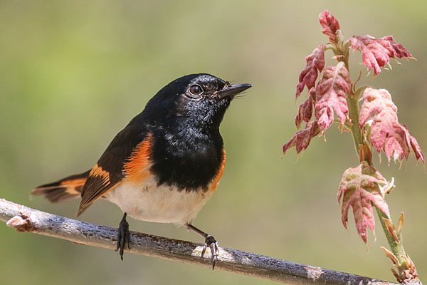
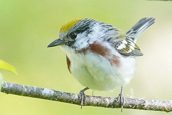
From late April through late May all of the typical spring songbird migrants in Massachusetts are possible here, and on the best days some in considerable numbers. When conditions are favorable, 10-15+ species of warblers are likely, along with an assortment of vireos, thrushes, kinglets, grosbeaks, orioles, and Purple Finches among others. Even on a slow day, one could easily spend a couple hours exploring all the nooks and crannies here, and if migrants are numerous half a day might not be enough. Because the habitat is fairly dry, mosquitoes are generally not too bothersome (but don’t leave the repellant in the car!). Some years ticks can be numerous along the grassy trail edges, so check your legs frequently. This is also a popular dog-walking area, so expect to make a few canine acquaintances during your visit.
An old railroad bed, now owned by the town and named the Old Colony Nature Pathway (hereafter, simply the “Pathway”), traverses the entire ridge longitudinally and provides easy access. Several smaller trails branch off from the Pathway. The best access point, and the only at which parking is available, is from Snail Road, the first left turn off Route 6 after you enter Provincetown (about three-quarters of a mile past the end of Pilgrim Lake). The Pathway intersects Snail Road a hundred yards or so south of Route 6 (look for the signs; Fig. 2). Park on either side of the road; there is room for several cars, but note that parking is limited to the designated areas.

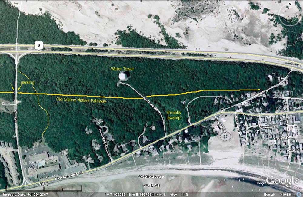
From Snail Road the Pathway runs both eastward for about a half mile, ending at a secluded residential area (Mayflower Heights), and westward for about a mile to its terminus at Howland Street. Most of the land north of the Pathway is state-owned, part of the Route 6 right-of-way. The land to the south of the Pathway is part town conservation land, part Provincetown Conservation Trust land, and part privately owned. The conservation land includes the Foss Woods tract, which encompasses about 15 acres south of the Pathway and east of Snail Road; Whistle Path Woods of about seven acres just to the west of Snail Road; and Fox Run, a small, narrow tract of 1.5 acres about halfway between Snail Road and Howland Street.
So far, the eastern portion of the area (i.e., east of Snail Road) has received far more attention from birders and seems to be more productive, though more extensive coverage of the western section may well change that perception. However, if your time is limited, your best bet is probably to head east.
Eastward from Snail Road the woods are initially a mix of Pitch Pine and small oaks. Almost immediately after starting down the Pathway, you will encounter a dirt crossroad that runs a short distance south, before ending behind the Cape Inn Resort Motel. Farther east along the Pathway the oaks become larger and predominate, and it is this stretch that typically hosts the most avian activity.
About 3/10 mile east of Snail Road a second crossroad – designated on some maps as Mt. Gilboa Road, though it is actually just an unmarked service road for the water tower – intersects the Pathway. To the left (north), the road is paved and runs steeply uphill to the water tower, which crowns the lofty summit of Mt. Gilboa. This “mountain” tops out at a sky-scraping 82 feet above sea level, making it one of the highest points of land in Provincetown!
To the right the road is dirt and runs south between a shrubby wetland and a low wooded hillside, ending at Route 6A. The area around this crossroad is often very active. Some of the largest oaks in the area are on the hillside below the water tower and the small clearing around the tower at the top of the hill can provide eye-level views of some treetop species. Early in the season, before the foliage becomes too thick, this clearing offers peek-a-boo views of Cape Cod Bay to the south and the vast Provincelands dunes to the north.
The swampy wetland is the most likely spot for things such as Northern Waterthrush, Canada Warbler, and other species that like their habitats damp. The small, wooded, east-facing hillside across the road from the swamp catches the early morning sun, is sheltered from the cool northerly winds, and can be quite busy.
Continuing eastward along the Pathway from the crossroad, you will pass through more deciduous woodlands and eventually pass behind several dwellings, before the Pathway ends at a small, residential road (Mayflower Avenue). A couple of small, ill-defined dead-end trails run north from the Pathway for a short way into the woods; these secluded trails may offer a better chance for shy birds such as thrushes.
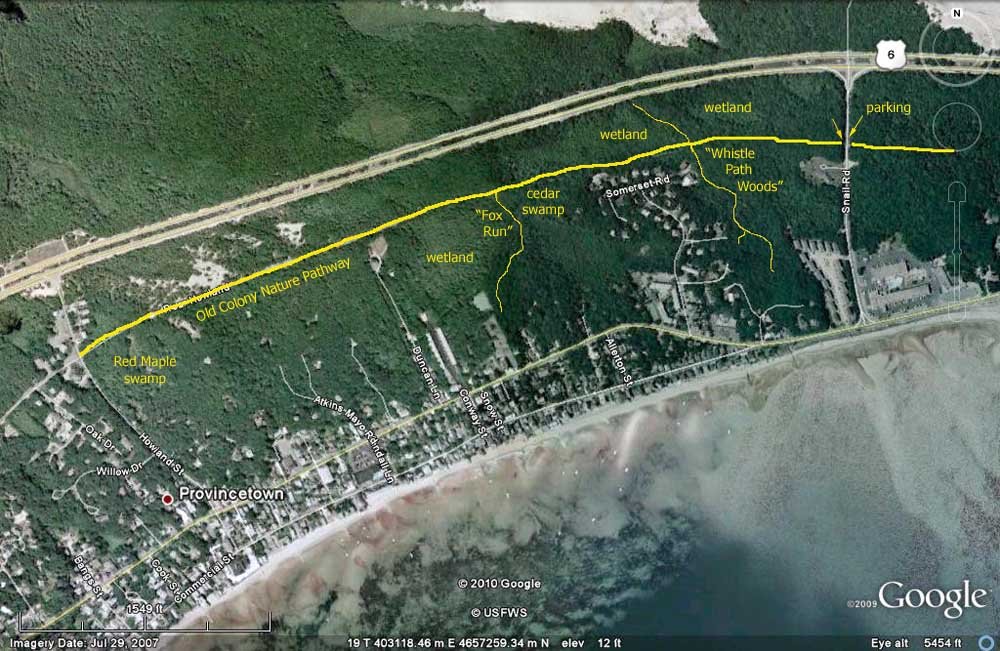
Heading west from Snail Road (Fig. 3), the Pathway initially passes through a stretch of oak woodland (including the Whistle Path Woods tract on the south side), before passing between a residential neighborhood to the south and a shrubby wetland to the north. Just before the residential area, a small sign marks a narrow trail that runs south from the Pathway through mixed woodlands, before ending at Thistlemore Road (when the path forks, keep left). On a good day, this trail is well worth checking. On the opposite side of the Pathway, another trail passes north along the eastern edge of the swamp before ending at Route 6. This swampy area, as well as a couple others farther west along the Pathway, may have a few species that are less likely in the drier woodlands (e.g., Northern Waterthrush, Canada Warbler, Swamp Sparrow).
Continuing west on the Pathway keep one eye on the houses on the south side, as a couple usually have active feeders. The Pathway then enters a stretch of dry, scrubby, unproductive upland, before passing another swamp (mostly White Cedar) to the south, part of which is within the small (1.5 acre) Fox Run conservation tract. Watch for a small sign (about 4/10 mile west of Snail Road) marking the beginning of a small trail that cuts south through the narrow cedar swamp and passes through more woodlands, before ending near some tennis courts and another residential area. This wooded hillside looks promising, but is largely unexplored.

The Pathway continues westward for another half mile or so, mostly through dry, scrubby habitat, before ending at Howland Street. Just before the end, is a Red Maple swamp that may have potential, but so far remains unexplored.
Foss Woods has produced such locally rare species as Golden-winged, Cerulean, Kentucky, Hooded and Worm-eating warblers, mulitple Summer Tanagers, Blue Grosbeak, and Clay-colored Sparrow. Coverage in the fall has been essentially non-existent, though that season would seem to have potential as well. There is no doubt that many additional avian delights await discovery here.
Now as I drive into P’town, and the lofty summit of Mt. Gilboa looms ahead, I no longer wonder about the area’s potential. Rather, I wonder why I ignored it for so long – and wonder what I missed there all those many years!
